Navigation Aid Symbols on a Sectional Chart
Símbolos de ayudas a la navegación en una carta seccional
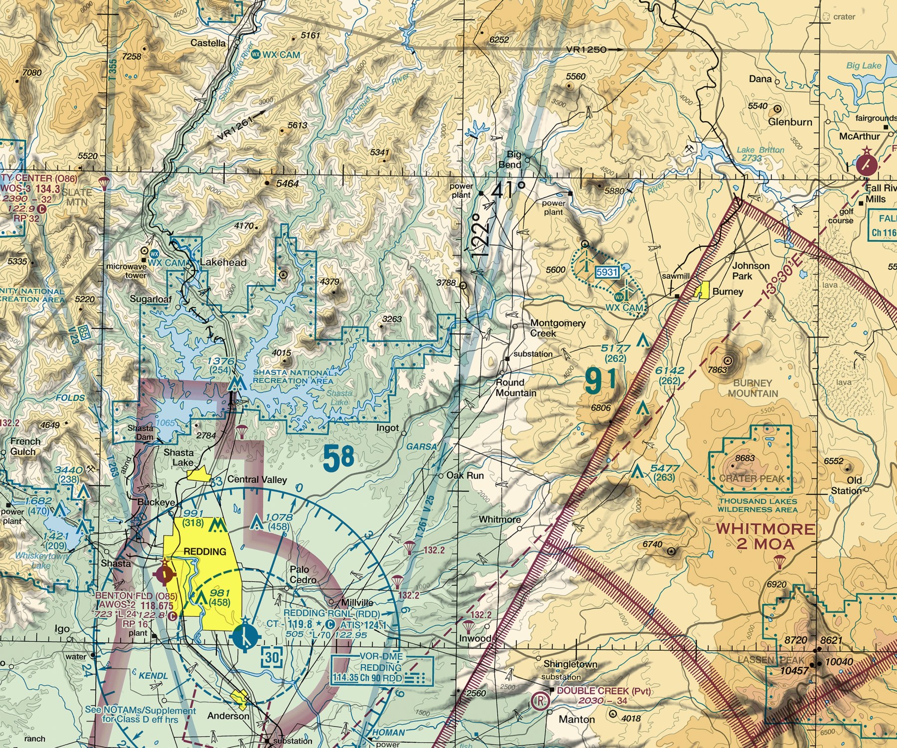
A real navigation aid symbol on the Klamath Falls sectional chart.
Un símbolo real de ayuda a la navegación en la carta seccional de Klamath Falls.
Identify a VOR station's compass rose symbol and its accompanying frequency/identification box on a sectional chart, and explain what information each part provides a pilot.
Before GPS, a VOR's charted symbol and frequency box were often the only tools a pilot needed to navigate accurately cross-country — and today they remain a required backup skill precisely because electronic navigation can fail.
Teach It / Enséñalo
ENTIENDE
Una estación VOR (Very High Frequency Omnidirectional Range) se representa en la carta usando un símbolo distintivo de ROSA DE LOS VIENTOS: un círculo marcado con marcas cada cierto grado alrededor de sus 360 grados completos, orientado al norte magnético, centrado en la ubicación real de la estación. Junto a la rosa de los vientos, una pequeña caja rectangular de FRECUENCIA E IDENTIFICACIÓN lista el nombre de la estación, su frecuencia, y su identificador en código Morse — una secuencia corta de puntos y rayas única para esa estación, que un piloto puede escuchar para confirmar que realmente ha sintonizado la estación correcta. Otros tipos de ayudas a la navegación (como los NDB, radiofaros no direccionales) usan sus propios símbolos de carta distintos, generalmente más pequeños y simples que una rosa de los vientos VOR completa.
¿Tiene sentido?
AVIATION WORDS · Palabras de aviación
DILO EN INGLÉS · SAY IT IN ENGLISH
“A VOR station is shown on the chart as a compass rose with a nearby box giving its name, frequency, and a Morse code identifier you listen for to confirm you've tuned the right station.”
Ejemplo guiado
A pilot tunes their navigation radio to a charted VOR frequency and listens for its Morse code identifier before relying on its bearing indication. Hearing a different identifier than expected would immediately warn the pilot that either the wrong frequency was entered or the equipment isn't working correctly — a real, practiced safety check, not a formality.
Real Aviation Application / Aplicación real en aviación
VOR navigation remains a required, tested skill in pilot training specifically as a non-GPS backup — a real pilot is expected to be able to identify a station by its Morse code and use its compass rose for basic bearing information even in an era where GPS handles most routine navigation.
Ask Your Teacher / Pregúntale a tu maestro
- How do I actually use a VOR's compass rose to figure out my position or a bearing to the station?
- Why does the U.S. still maintain VOR stations at all if most pilots primarily use GPS now?
- What's the practical difference between a VOR and an NDB for someone actually navigating?
HAMPTON'S .02 CENTS
Playing an actual recorded VOR Morse code identifier (many are short and easy to find as reference audio) alongside its charted symbol makes this lesson far more concrete than describing the identification process in words alone — hearing it is genuinely different from reading about it.
It Would Behoove You… Continue to the final lesson in this unit: putting every symbol from this unit together on one chart excerpt.
Standards Alignment
CLASSROOM: Sectional Chart Reading — Navigation Aids
FAA: FAA Aeronautical Chart User's Guide; FAA-H-8083-25 (Pilot's Handbook of Aeronautical Knowledge), Chapter 16: Navigation
CERTIFICATION: Private Pilot
SOURCES: Aeronautical Chart User's Guide; Pilot's Handbook of Aeronautical Knowledge (FAA-H-8083-25)